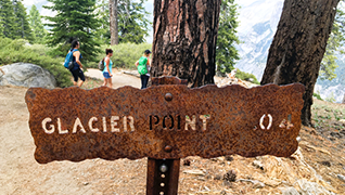
Yosemite Planet - Glacier Point
Glacier Point Hikes and Road Information - MAP LINK
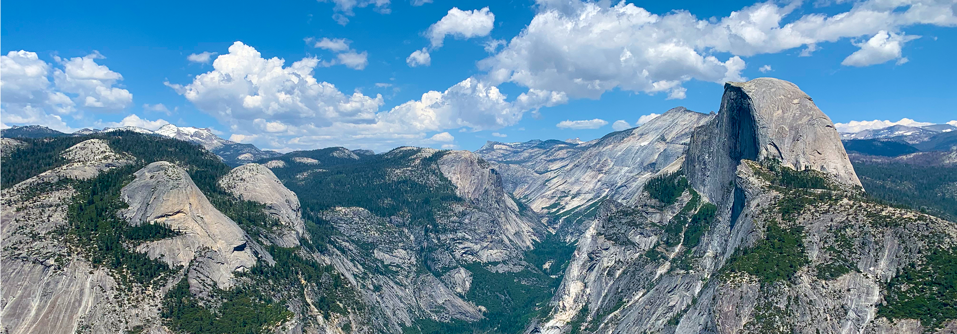
From the top of Glacier Point, you can take in a stunning panorama of Yosemite National Park's iconic features, such as Yosemite Valley, the cascading Yosemite Falls, the majestic Half Dome, and the powerful Vernal and Nevada Falls. In the distance, the distinct summit of Clouds Rest can also be seen. Notably, this location was also the stage for the famed Yosemite Firefall spectacle, which occurred between 1872 and 1968.
There are three ways to get to Glacier Point. You can hike up the Four Mile Trail from Yosemite Valley, which is very strenuous, take a bus (seasonal) or you can drive up Glacier Point Road. Glacier Point Road is closed during the winter and early spring. Please check the NPS website for current closure information. Once the road opens, trails can remain wet and/or snowy for a few to several weeks. The Glacier Point Road usually closes sometime in November. Click on this LINK for a pocket map of the hikes in the Glacier Point Area.
Easy
Glacier Point 300 yards one way. 5 minute STROLL.
The fastest way, but not the only way, to get to Glacier Point is by vehicle. Once you reach the top, you can park and take a 5 minute stroll to one of the most spectacular views you have ever seen! Come for the sunrise or stay for the sunset. Start at the Glacier Point parking area and enjoy a leisurely stroll, which is also wheel chair accesible to the Glacier Point railing, where you look down on Yosemite Valley (3,200 below!) and east toward Half Dome and the High Sierra.
McGurk Meadow 1.6 miles (2.5 km) round-trip. 1–2 hours; 150 ft (50 m) elevation change. Begin at McGurk Meadow trailhead. The trail leads downhill 0.8 mile (1.3 km) to McGurk Meadow and the site of an old cabin that belonged to shepherd John McGurk. During early summer, look for a tremendous show of wildflowers. You can continue along the trail an additional mile (1.6 km) to reach the Pohono Trail, which runs west to Dewey Point and Tunnel View and east to Bridalveil Creek, Taft Point, and Glacier Point.
Moderate
Dewey Point 8.2 miles (13.2 km) round-trip. 4–6 hours; 750 ft (225 m) elevation change. Begin at McGurk Meadow trailhead Begin by following the McGurk Meadow trail as described above. Continue one mile (1.6 km) past the meadow to reach an intersection with the Pohono Trail. Follow the Pohono Trail west (left) to Dewey Point, 4.1 miles (6.6 km) from the trailhead. Enjoy the unique views of El Capitan, Cathedral Rocks, Half Dome, and the Yosemite high country. Return the same way, or you can continue on the Pohono Trail west to more viewpoints and eventually the Tunnel View parking area 5.5 miles (8.9 km) beyond Dewey Point.
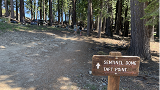
Taft Point & The Fissures 2.2 miles (3.5 km) round-trip. 2 hours (200 ft (60 m) elevation change). Begin at Sentinel Dome/Taft Point trailhead Begin with an easy walk through the forest past a wildflower-filled meadow (seasonal), the trail leads to an expanse on the south rim of Yosemite Valley. Taft Point is marked by a small railing at the cliff’s edge. Enjoy magnificent views of Yosemite Valley, including El Capitan and Yosemite Falls. Near Taft Point, you’ll see the Fissures—narrow fractures in the granite called joints. Watch out for drops near these fractures of up to 2,000 feet!
Sentinel Dome 1.8 miles (2.9 km) round-trip. 2 hours; 400 ft (125 m) elevation change. Begin at Sentinel Dome/Taft Point trailhead .This wide trail leads mostly across open granite with little shade. The trail meets an old road near the base of Sentinel Dome. Follow the road to the northeast side of the dome where the incline is less imposing. From here, scramble up the granite slope to the top of the dome. Enjoy a breathtaking 360-degree view of the park. Consider taking this hike at sunset or during a full moon, but remember to bring a flashlight with fresh batteries!
Sentinel Dome/Taft Point Loop 4.9 miles (7.9 km) loop. 3–4 hours; 1,000 ft (300 m) elevation change. Begin at Sentinel Dome/Taft Point trailhead The Sentinel Dome and Taft Point trails can be combined into a loop hike. For a counterclockwise loop, start by hiking Sentinel Dome’s northeast side as described previously. After descending the same northeast slope, follow the trail north to the Pohono Trail junction. Take the Pohono Trail southwest, descending to Sentinel Creek before climbing to the Taft Point trail junction. From here, Taft Point sits a half mile downhill to the west (right), while the trailhead is a half mile to the east (left). For a clockwise loop, begin with Taft Point and follow the Pohono Trail to Sentinel Dome, returning to the trailhead via the Sentinel Dome trail.
Strenous
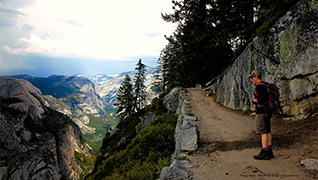
Four Mile Trail 4.8 miles (7.7 km) one way. 3–4 hours; 3,200 ft (975 m) elevation change.Begin at Glacier Point parking area The Four Mile Trail follows a series of switchbacks down the south wall of Yosemite Valley. Although lacking shade during the heat of summer, this trail has no lack of views—El Capitan and the Cathedral Rocks tower to the west, while Yosemite Falls plummets in the north and Half Dome looms eastward. The trail ends about a mile west of Yosemite Village, which is accessible by riding the El Capitan Shuttle (summer only) or by crossing the Merced River on Swinging Bridge.
Panorama Trail 8.5 miles/13.7 km one-way to Valley floor (via Mist Trail); 6 hours for 3,200 ft/975 m descent. Begin at the Panorama Trailhead, Glacier Point. As its name implies, this trail offers some incredible panoramic views of Yosemite Valley. The trail crosses Illilouette Fall after 2 miles (3.2 km) and continues partially uphill along the Panorama Cliff. At the top of Nevada Fall, the trail joins the Mist and John Muir Trails to Happy Isles. In the summer, hikers may purchase a one-way bus ticket to Glacier Point ($) and hike down. Reservations required; visit a tour desk for details.
Mt. Starr King View 3 miles (4.8 km) round-trip. 2–3 hours; 900 ft (275 m) elevation change. Begin at Mono Meadow trailhead The trail descends steeply to Mono Meadow—an area that is very wet throughout the summer. Expect log crossings over creeks and lots of mud. Follow the trail from the east end of the meadow for a half mile (0.8 km) to an unmarked clearing. Enjoy magnificent views of the Clark Range, Mt. Starr King, and Half Dome. Adventurous hikers can continue another 1.5 miles (2.4 km) downhill to Illilouette Creek (no footbridge). A turn left (north) at the junction brings hikers an additional 3.5 miles (5.6 km) to Glacier Point, climbing 1,000 ft (240 m).
Ostrander Lake 11.4 miles (18.3 km) round-trip. 8–10 hours; 1,500 ft (450 m) elevation change .Begin at Ostrander Lake trailhead. The first half of this hike gently inclines through forest and meadow where you can observe severe scars and regrowth from a 1987 lodgepole pine forest fire. A steep 1,500 foot (450 m) elevation gain opens up to views of granite domes, Mt. Starr King, and the Clark Range just prior to arriving at Ostrander Lake.