Yosemite Planet - White Wolf & Crane Flats
White Wolf & Crane Flats Hikes - MAP LINK
Crane Flats is accessible by car year-round, though tire chains may be required from October through April. A gas station is open year-round at Crane Flat. Yosemite Area Regional Transportation (YARTS) provides public transportation to/through Crane Flat (summer only; fee required). The Tuolumne Meadows Hikers' Bus also stops at Crane Flat (summer only; fee required).
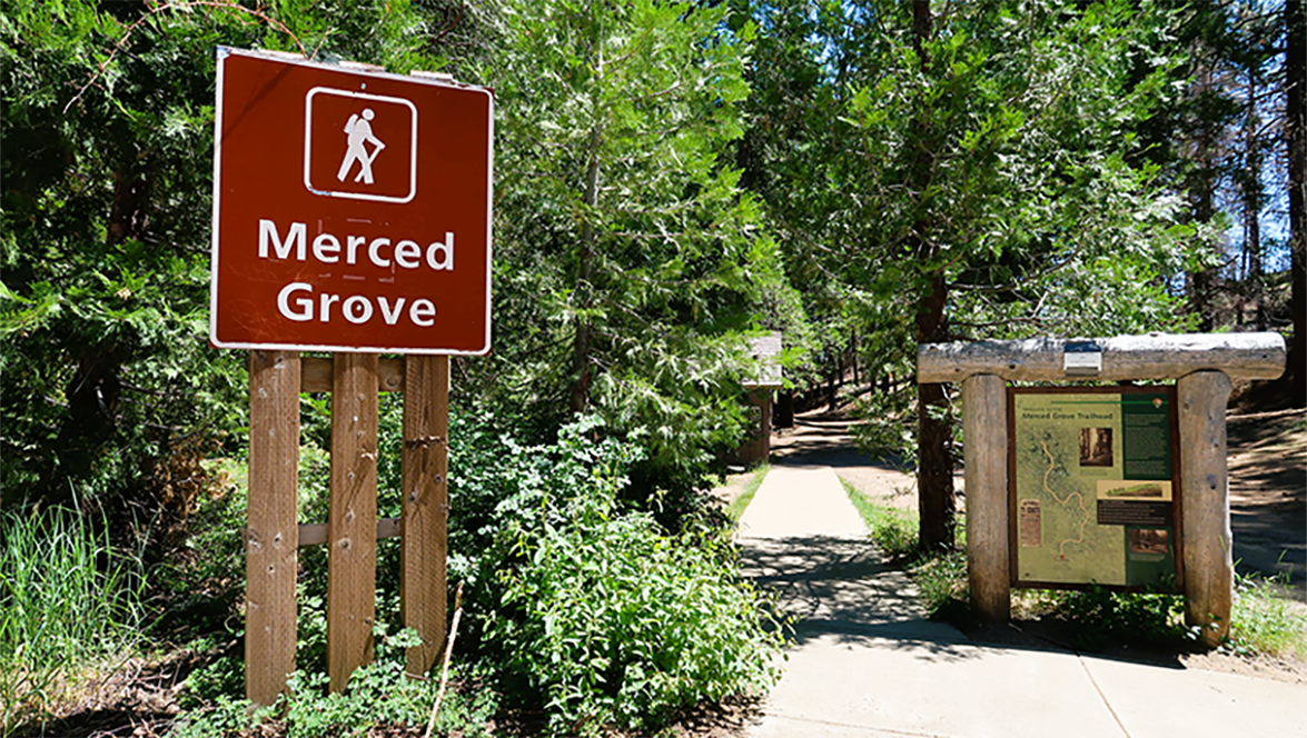
The Tuolumne Grove and the Merced Grove are two small, quiet groves of giant sequoias. Both located near Crane Flat, about 30 minutes from Yosemite Valley. Parking at each trailhead is very limited. Both groves can be visited year-round. In winter, skis or snowshoes may be necessary.
White Wolf Campground is located off the Tioga Road between Tuolumne Meadows and Crane Flat, approximately an hour from Yosemite Valley at 8,000 feet (2,400 m). The campground is tucked into the forest about a mile from Tioga Road near White Wolf Lodge. Trailheads nearby lead to Lukens and Harden Lakes and the area is popular for those accessing other wilderness destinations. Minimal services may be available at White Wolf Lodge (if open). There are no other visitor services close to the campground.
Easy Hikes
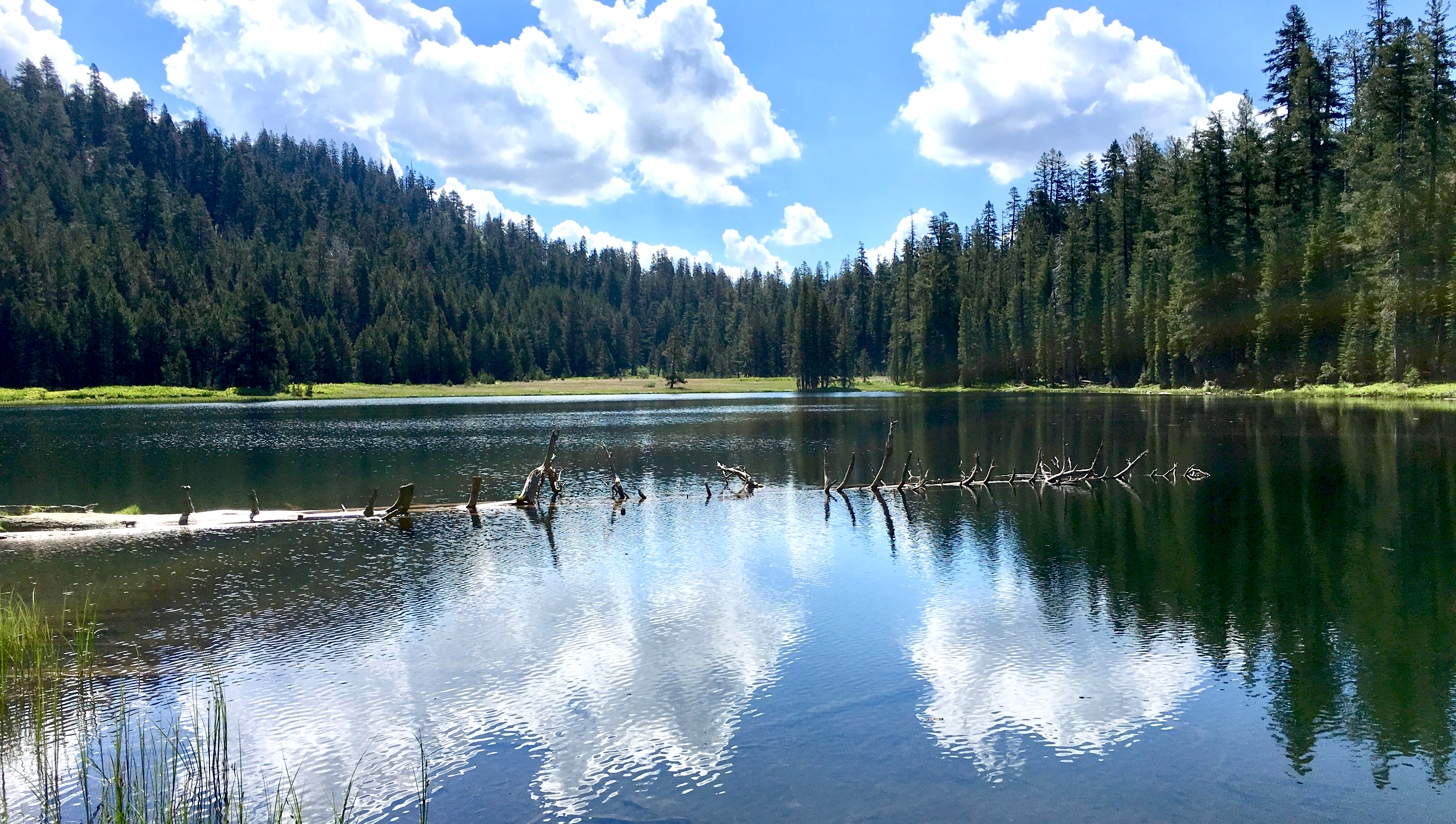
Lukens Lake from Tioga Road - 1.6 miles (2.6 km) round trip. 200-foot (61-m) elevation gain. 1-2 hours.
Begin at Lukens Lake Trailhead on Tioga Road, 2 miles east of White Wolf Road. The trail winds through a mixed conifer forest, then over a saddle and down to a small mountain lake surrounded by a meadow. Shooting stars and dozens of other species of wildflowers abound, often through July. Please stay on designated trails to protect the meadow. The trail is wet and muddy until early August.
Moderate Hikes
Tuolumne Grove and Nature Trail. 2.5 miles (4 km) round trip; 500- foot (152-m) elevation gain on the return trip. 1-2 hours.
Begin at Tuolumne Grove parking lot at Crane Flat on Tioga Road. Follow the Old Big Oak Flat Road—one of the first roads into Yosemite Valley—steeply down 0.8 mile (1.3 km) through sugar pines and white firs to the “Entering the Tuolumne Grove of Giant Sequoias” sign. The first sequoia is 0.2 mile (0.3 km) past the sign. To see more sequoias, follow established trails through the grove. Take a 0.5-mile (0.8-km) nature trail through the grove to learn more about these giant trees. Begin the trail at the Tunnel Tree, then bear left down the road, and cross the bridge at the right side of the picnic area. To return to the parking area, take the road uphill. The road downhill continues 4.5 miles (7.2 km) to the Hodgdon Meadow area.
Merced Grove - 3 miles (4.8 km) round trip; 520- foot (158-m) elevation gain on return. 1-3 hours.
Begin at Merced Grove parking lot on Big Oak Flat Road. This trail follows an old road that curves down into the Merced Grove, the smallest and most secluded of Yosemite's three sequoia groves. Follow the trail for 0.6 miles (1 km), then bear left at the junction. An old cabin, the former summer retreat of park superintendents, is part of the grove's history. Look for dogwoods blooming here in the spring. This trail is usually not crowded and is one of my favorites.
Lukens Lake from White Wolf - 4.6 miles (7.4 km) round trip; 400- foot (122-m) elevation gain. 2-3 hours.
Begin across from White Wolf Lodge. Follow the trail through a mixed conifer forest to Lukens Lake, a small mountain lake surrounded by a meadow. The trail crosses the Middle Fork of the Tuolumne River and is wet and muddy until early August. At the lake, shooting stars and dozens of other species of wildflowers abound, often through July. Please stay on designated trails to protect the meadow.
Harden Lake - 5.8 miles (9.3 km) round trip; 355-foot (122-m) elevation gain on the return trip. 2-4 hours.
Begin across from White Wolf Lodge. Hike along a gravel road—part of the original Tioga Road—that follows the Middle Fork of the Tuolumne River for part of the route. At a trail junction 1.75 miles (2.8 km) down the road, follow the signs to the lake. The trail passes by small granite domes and through a forest of red fir and lodgepole pine to reach boulder-dotted Harden Lake.
Optional loop to the edge of the Grand Canyon of the Tuolumne River. 8.4 miles (13.5 km)loop.
1,000-foot (305-m) elevation gain on the return trip. 5-8 hours.
Beyond Harden Lake, descend into a large aspen grove full of seasonal flowers, which can be wet and muddy until early August. At the next trail junction, 1.3 miles (2 km) from Harden Lake, turn south towards Lukens Lake and continue towards the White Wolf junction for 2.7 miles (4.3 km). Follow the trail 0.8 miles (1.3 km) back to White Wolf Lodge.
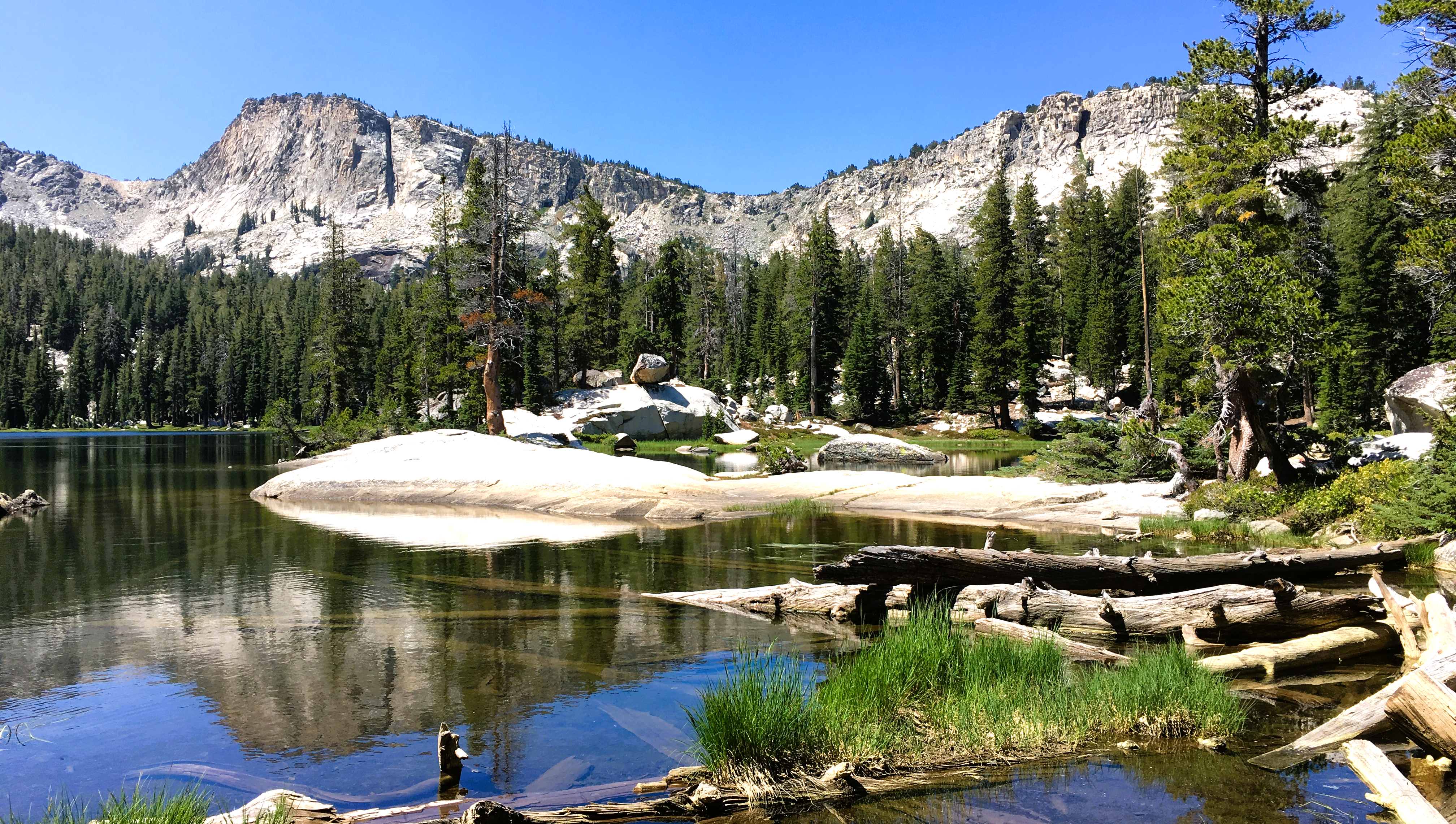
May Lake - 2.4 miles (3.9 km) round trip. 485-foot (148-m) elevation gain. 1-2 hours.
Begin at the May Lake parking area, 1.75 miles (2.8 km) north of Tioga Road. A short trail leads through a conifer forest and across granite slabs to reach May Lake. Enjoy views of Half Dome and surrounding mountains on the way.
Strenous Hikes
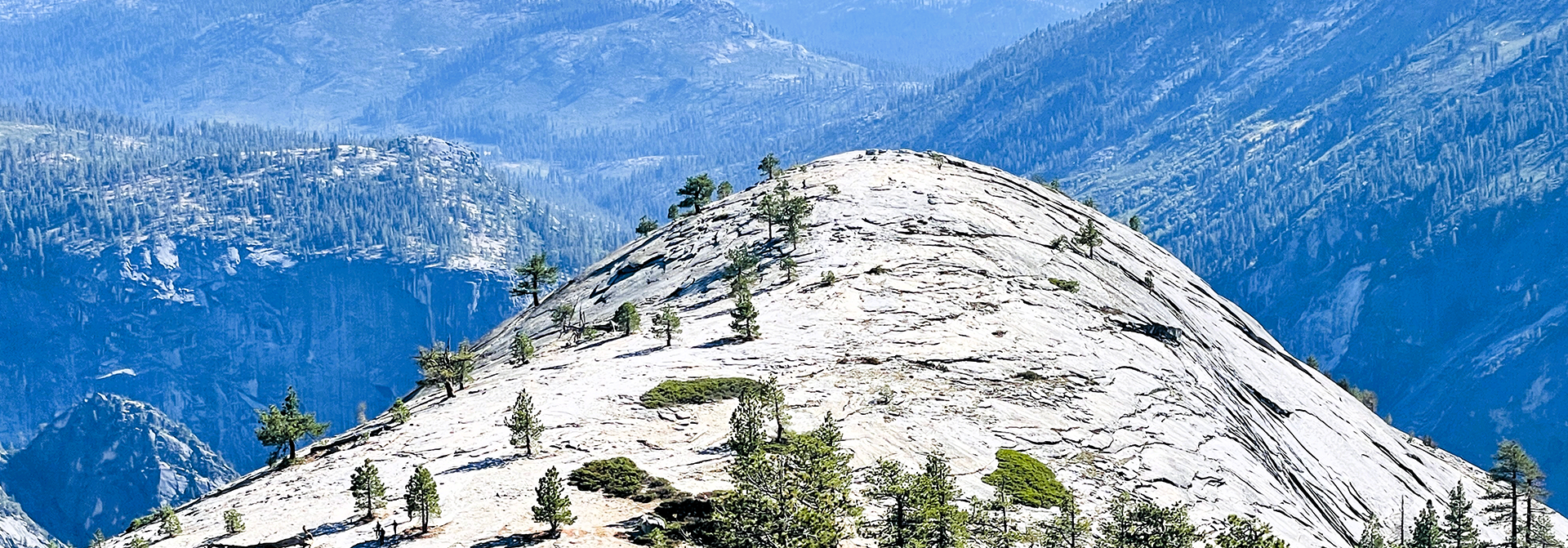
North Dome - 10.4 miles (16.7 km) round trip. 580-foot (177-m) elevation gain on return. 5-8 hours.
Begin at Porcupine Creek Trailhead on Tioga Road, 1.2 miles (1.9 km) east of Porcupine Flat Campground Wind through mixed-conifer forest for 0.7 miles (1 km) on a paved path, and cross Porcupine Creek. At each of several trail junctions, follow the signs toward North Dome. The trail passes through a small grassy meadow and descends along a ridge. Near the end of the hike, descend steep rock steps to the base of North Dome. Climb the dome’s rounded summit to take in a magnificent view of Half Dome and Yosemite Valley. On the return trip you can take a short detour on a side trail, 0.3 mile (0.5 km) to an unusual natural arch, Indian Rock.
Ten Lakes - 12.6 miles (20.3 km) round-trip; 2,200-foot (671-m) elevation gain. 6-8 hours.
Begin at Ten Lakes Trailhead, across Tioga Road from Yosemite Creek Picnic Area. Follow this trail through conifers and across granite to cross a tributary of Yosemite Creek. Takecare on this crossing early in the season when the creek is high. Continue on the trail to Ten Lakes Pass, over-looking the Grand Canyon of the Tuolumne and the Sierra Crest. Then descend 693 feet (211 m) into the Ten Lakes Basin, which contains a series of beautiful High Sierra lakes. Grant Lakes is at the end of a 1-mile (1.6-km) side trail from the pass.